Visualizzerò dati geospaziali sulla mappa di calore 3d con griglia esagonale h3

A
arsenkocharyan
A
arsenkocharyan
Arsen K
Alcune informazioni sono state tradotte automaticamente.

Informazioni su questo servizio

Traduzione automatica.

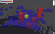
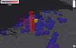
Cattura un'impressione potente e incredibile sui visitatori del sito con le mappe interattive tridimensionali!


Ottieni l'estetica futuristica perfetta heatmap 3D dinamica per analisi geospaziale.

Visualizza i dati geospaziali rappresentati in:

  • Excel / CSV / TEXT
  • PDF / DOC
  • JSON / XML
  • GeoJSON / KML / Shapefile

su una impressionante e coinvolgente griglia esagonale come Uber Heat Map interattiva 3D per il tuo sito web.

Ricorda che l'applicazione web sarà basata su una libreria di mapping gratuita con fornitori di tile map gratuiti!


IMPORTANTE:  Contattami prima di ordinare il servizio.

Scopri di più su Arsen K

Arsen K
4,7(8)
  • DaArmenia
  • Membro daago 2017
  • Ultima consegna3 mesi
  • Lingue

    Russo, Armeno, Inglese, Francese
Salut ! I'm a former Computer Information System (CIS) Instructor. The CIS Tools has a crucial meaning for a business. They helps you to monitor and estimate either the state of each part of system or the state of entire system. Rationally distribute the resources between each nodes of a system. Analyze, evaluate and forecast the dominant trends. The main requirements for this sphere are: Autonomous ( independence, initiative, self motivated ... ) Versatility ( abstract-logical thinking, flexible, adaptive)

Traduzione automatica.