Sfoglia categorie
Esplora
Fiverr Pro
Italiano
$
USD


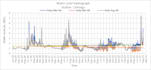
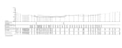

Send me your bathymetric or topographic survey data and I will return a clean, accurate, report-ready deliverable.
I am a water resources engineer with 6+ years of professional experience processing bathymetric, hydrographic, and topographic survey data for major river, port, and infrastructure projects in Bangladesh. My portfolio includes work on the Matarbari Port Development Project for Nippon Koei (Japan), multiple bridge feasibility studies over the Meghna, Jamuna, and Padma rivers, and the Padma River erosion protection study.
What I process:
What you receive:
GIS and Survey Data Processing Specialist
Lingue
Q1: What file formats do you accept?
A1: XYZ, CSV, TXT, ASCII from HYPACK, WinRiver-II, HydroPRO, or Trimble. If you have something unusual, send a sample and I will confirm.
Q2: What output formats can you deliver?
A2: PDF, DXF, DWG, GeoTIFF, shapefile, KML, CSV, and any custom format specified in your order.
Q3: Can you handle large datasets over 100,000 points?
A3: Yes. Large datasets are best handled under the Premium package or a custom offer. Send me the file size and I will recommend the right setup.
Q4: What coordinate systems do you work with?
A4: UTM zones worldwide, WGS-84, local national grids (BTM, Everest 1830, etc.), and custom projections. I will verify your datum before processing.
Q5: Can you generate volume or dredging calculations?
A5: Yes — included in the Premium package. Requires a reference surface which you can provide or I can set up.
Q6: Is my survey data kept confidential?
A6: Yes. All files are handled privately, never shared, and deleted after delivery unless you request otherwise. Happy to sign an NDA for sensitive projects.


