Sfoglia categorie
Esplora
Fiverr Pro
Italiano
$
USD

Hello Great Buyer!!!
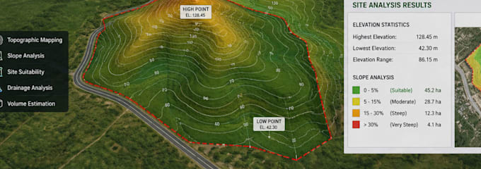
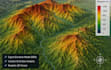
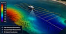
Did you need accurate 3D bathymetry mapping, GIS terrain modeling, site analysis, or topographic visualization for your project? You're in the right place!
I provide professional 3D bathymetry mapping, GIS terrain models, site analysis, and topography services for engineering, marine, environmental, architectural, and land development projects. Using advanced geospatial workflows and precise terrain modeling techniques, I deliver detailed visualizations and analytical outputs that help support planning, design, and decision-making.
Whether you need seabed mapping, elevation analysis, terrain visualization, or land suitability studies, I can transform your raw survey, contour, DEM, or GIS data into clear and professional deliverables.
I work with clients in construction, marine projects, land development, urban planning, and environmental analysis to deliver accurate terrain and spatial solutions tailored to their needs.
Please contact me before placing an order so we can discuss your project
THANNKS!!!
Informa il freelance di eventuali preferenze o preoccupazioni relative all'uso di strumenti di IA nel completamento e/o nella consegna dell'ordine.
where imagination turns to reality
Lingue