Sfoglia categorie
Esplora
Fiverr Pro
Italiano
$
USD
Idraulico
Ciao, sono Bibek, laureato in Idrologia e Meteorologia in Nepal, con esperienza reale nell'analisi della portata dei fiumi, elaborazione dei dati di pioggia e mappatura GIS usando QGIS e Python.
Ho lavorato con dataset reali, tra cui i dati dei fiumi Trishuli e West Rapti, utilizzando fonti DHM e Satelliet (GeoGLOWS).
Ciò che offro:
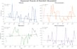
Analisi dei dati con Python
Mappatura con QGIS
Perché scegliermi:
Ideale per:
Contattami prima di ordinare così posso confermare di poter consegnare esattamente ciò di cui hai bisogno.




Traduzione automatica.
Quali dati devo fornire?
Per l'analisi fornisci i tuoi dati di deflusso o pioggia in formato CSV o Excel. Per la mappatura fornisci il nome dell'area di studio o shapefile se disponibile.
Puoi lavorare con dati fuori dal Nepal?
Sì, posso lavorare con dati idrologici di qualsiasi paese, purché tu fornisca i dati.
Quale software utilizzi?
Utilizzo Anaconda Jupyter Notebook con Pandas, Matplotlib e Seaborn per l'analisi dei dati e QGIS per tutte le operazioni di mappatura.
Puoi aiutare con mappe e analisi per tesi?
Sì, sono specializzato nell'aiutare studenti universitari con mappe dell'area di studio e analisi idrologiche per tesi e articoli di ricerca.
Manterrete i miei dati riservati?
Sì, i tuoi dati e le tue ricerche sono completamente privati e non saranno mai condivisi con nessuno.


