Sfoglia categorie
Esplora
Fiverr Pro
Italiano
$
USD

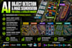
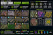
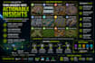
Need to automatically detect, count, segment or map objects from aerial, satellite or drone imagery?
I develop custom GeoAI, computer vision, object detection and image segmentation solutions for geospatial imagery using deep learning.
Potential use cases include:
I can provide detection, counting, segmentation, classification, model training/fine-tuning, large-area inference, QA/QC and GIS-ready vector outputs.
Technologies include YOLO, U-Net, FPN, SAM, PyTorch, Python, GeoPandas, Rasterio, GDAL, ArcGIS and QGIS.
Have a unique target object? Message me with a sample image and your requirements before ordering.
GIS Developer
Lingue
1. What objects can you detect from aerial or satellite imagery?
I can build workflows for vehicles, trailers, shipping containers, buildings, rooftops, roads, sidewalks, solar panels, trees, construction equipment, ships, scrapyards, waste sites and many other custom objects visible in your imagery.
2. Can you detect a custom object not listed in your Gig?
Yes. Send me sample imagery and explain what you want to detect, count, classify or segment. I will assess the imagery and recommend the most suitable AI approach.
3. Can you train a custom AI model for my project?
Yes. I can train or fine-tune object detection and segmentation models using your labelled data or help design the appropriate training workflow.
4. Which AI models and technologies do you use?
Depending on the project, I work with YOLO, U-Net, FPN, SAM, PyTorch and other computer vision/deep learning approaches, together with Python and GIS tools.
5. Can you work with satellite, aerial and drone imagery?
Yes. I can process satellite imagery, aerial photography, drone imagery and georeferenced orthomosaics. Suitability depends on image resolution and the size/visibility of the target object.
6. Can you provide GIS-ready results?
Yes. AI predictions can be processed into GIS-ready outputs such as GeoJSON, Shapefile, GeoPackage, GeoTIFF, raster masks or other suitable formats, including attributes and object counts where required.
7. Do I need to contact you before ordering?
Please message me first for custom model training, large datasets or unusual target objects. Send a few sample images, your target features and expected output so I can confirm feasibility and recommend the right package.


