I will help you complete gis and qgis university projects

C
creative_gis
C
creative_gis
D D Sharika
Alcune informazioni sono riportate in lingua inglese.

Informazioni su questo servizio

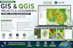
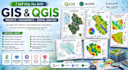
Are you struggling with your GIS or QGIS assignments, research work, or mapping projects?

You are in the right place!

I will help students, researchers, and professionals complete high-quality GIS and QGIS projects accurately and professionally.

I have experience in spatial analysis, map creation, georeferencing, digitization, and cartographic visualization using industry-standard GIS techniques.

Services I Offer

  • QGIS Project Assistance
  • GIS Assignments and Lab Tasks
  • Spatial Analysis and Mapping
  • Georeferencing Raster Images
  • Shapefile and Geodatabase Creation
  • Vector Digitization (Points, Lines, Polygons)
  • Coordinate System & Projection Fixing
  • Thematic Map Preparation
  • Buffer, Overlay & Proximity Analysis
  • DEM, Contour, Slope & Hillshade Mapping
  • Research Study Area Maps
  • Map Layouts for Reports and Presentations

Why Choose Me?

  • Accurate and professional outputs
  • Fast response and delivery
  • High-quality map layouts
  • Friendly communication
  • Support for university and research projects

Whether you are a university student, researcher, or beginner in GIS, I can help you complete your work efficiently and professionally.

Feel free to contact me before placing the order.

Scopri di più su D D Sharika

D D Sharika

The Best Solution for You

  • DaSri Lanka
  • Membro damag 2025
  • Lingue

    Singalese, Inglese
Hi, I’m Dilki Sharika — a graduated student at Sabaragamuwa University of Sri Lanka, specializing in Geographic Information Systems (GIS) as part of my B.Sc. (Hons) in Surveying Science. I bring expertise in map visualization, digitizing, and Land Use/Land Cover (LULC) analysis, using industry-standard software like ArcGIS, ArcGIS Pro, and QGIS. Whether you need precise maps, spatial data analysis, or help with GIS-related assignments, I deliver high-quality, purpose-driven outputs tailored to your needs. Let’s bring your GIS project to life with clarity, accuracy, and professionalism

Il mio portfolio