Sfoglia categorie
Esplora
Fiverr Pro
Italiano
$
USD

Dimas Gis
@danielkimaru
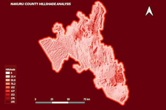
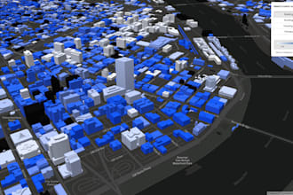
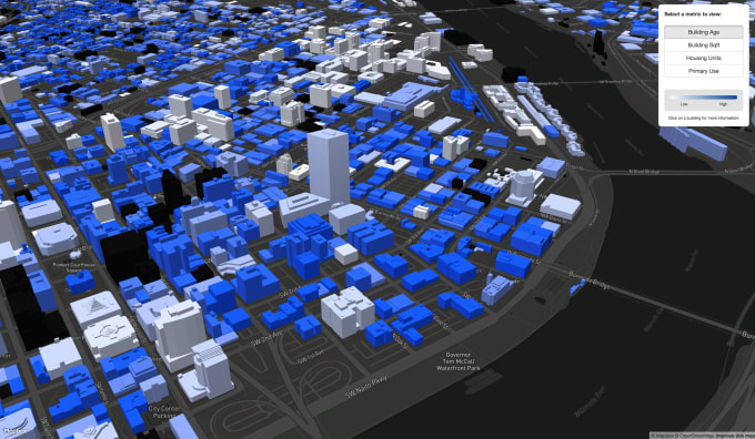
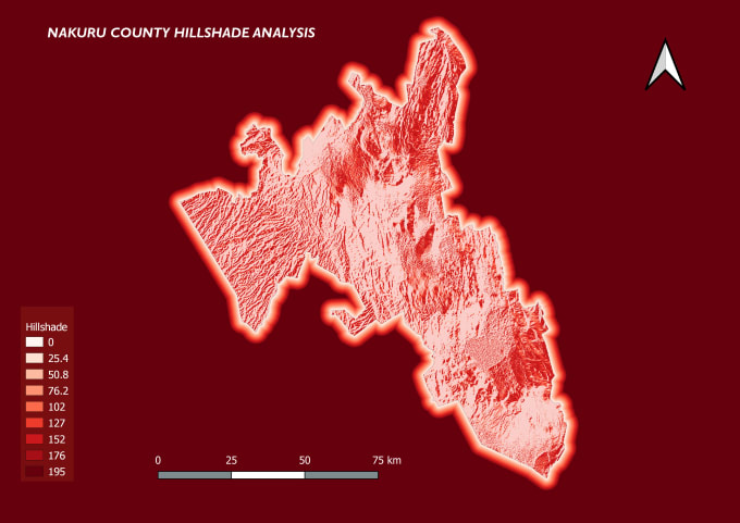
Mapping the Future with Precision and Innovation
Kenya
Inglese
Chi sono
Hello!
I will make Your Remote Sensing And GIS Based Projects Using Esri’s Geographic Information System (GIS) software, I can help you visualize your data in new and different ways, unearth geographic patterns hidden in your data, and convey that information in a straightforward manner.
I offer the following services:
Classification (Supervised & Unsupervised)
Spatial Analysis
Cartography
Geo-visualization
Digital Mapping and Image Processing etc
I have worked on Remote Sensing Data Satellite Imagery.
Competenze

Dimas Gis
offline •
Tempo di risposta medio: 16 ore
Consulta i miei servizi

Applicazioni web full stack
I will create interactive webmap using leaflet, mapbox, open layers

Geographic Information Systems (GIS)
I will do gis, interactive mapping, vector map, spatial analysis
Vuoi lavorare su base oraria?
Spiega a Dimas Gis cosa ti serve.
20 USD
/
oraPortfolio
4 Recensioni
| (4) | ||
| (0) | ||
| (0) | ||
| (0) | ||
| (0) |
Valutazione dettagliata
- Livello di comunicazione del venditore
- Consiglia a un amico
- Servizio conforme alla descrizione
1-4 di 4 recensioni
Ordina per
Più rilevante

kriskenbe

Belgio
Great guy to work with! Very good in communication Will think together with you.
Utile?
samialsaeed

Australia
Utile?
user82502414

Stati Uniti
Delivery of project was timely and he understood our requirements for the locator map. Will definitely be using for future projects.
Utile?

normandan

Kenya
The seller is very polite and is understanding. He delivers his work in good time and the work is of great quality. Looking forward to work him again in future orders.
Utile?

