Sfoglia categorie
Esplora
Fiverr Pro
Italiano
$
USD
Ingegnere geologico
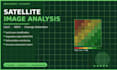
Hai bisogno di analizzare i cambiamenti nella copertura del suolo, la salute della vegetazione, la deforestazione o i cambiamenti costieri dai dati satellitari? Fornisco risultati precisi e riproducibili con mappe chiare e un riassunto scritto. Elaboro le immagini usando ArcGIS Pro e PCI Geomatica, e attualmente contribuisco a un progetto di ricerca costiera dell'IAEA utilizzando metodi di telerilevamento.
SERVIZI: classificazione dell'uso del suolo / copertura del suolo (LULC), mappatura degli indici di vegetazione NDVI, EVI, SAVI, rilevamento dei cambiamenti tra due periodi, monitoraggio della deforestazione e della copertura forestale, analisi dei cambiamenti costieri e delle linee di riva, valutazione dell'accuratezza con matrice di confusione.
CONSEGNABILI: mappe classificate in alta risoluzione (PDF/PNG), tabella di valutazione dell'accuratezza, breve interpretazione scritta dei risultati.
Condividi la tua area di interesse e il periodo di tempo al momento dell'ordine.

Tecnologia:
ArcGIS
Expertise:
Trend
•
Statistiche
•
Analisi dei cluster
Linguaggio di programmazione:
Python
