Pubblica il tuo libro
Crea il tuo sito web
Crea il tuo marchio
Fai crescere il tuo pubblico
Trova un lavoro
Servizi di IA
Logo e Brand identity
Grafica e Illustrazione
Varie
Design web e app
Prodotto e Gaming
Stampe
Libri e eBook
Design visivo
Design marketing
Moda e Accessori
Design 3d
Trova animatori, designer, editor video, doppiatori e altro ancora.
Cloud e sicurezza informatica
Trova sviluppatori di app, web designer, esperti di intelligenza artificiale e altro ancora.
Social
Specifico per canale
Metodi e tecniche
Scala il tuo marketing con l'IA
Analitica e strategia
Settore e scopo specifico
Trova specialisti SEO , esperti di marketing digitale, esperti di vendite, responsabili social media e altro ancora.
Editing e post produzione
Video per social e marketing
Video di presentatori
Motion graphics
Animazione
Produzione di video filmati
Video didattici
Video prodotti
Scrittura contenuti
Revisione e critica
Pubblicazione libri ed ebook
Scrittura professionale
Copy di vendita e marketing
Traduzione e trascrizione
Contenuto settorialenuovo
Trova copywriter, creatori di contenuti, correttori di bozze, traduttori e altro ancora.
Ingegneria del suono e post-produzione
Streaming e audio
DJ
Design del suono
Lezioni e trascrizioni
Formazione aziendale e consulenza
Operazioni e gestione
Vendite e assistenza clienti
Trova contabili, avvocati, commercialisti, project manager e altro ancora.
Sviluppo IA mobile
Dati
Artisti IA
IA per aziende
Audio IA
Contenuto IA
Auto-miglioramento
Hobby e tempo libero
Moda e stile
Benessere e Fitness
Consulenti di business
Strategia di marketing
Consulenza dati
Consigli e coaching
Consulenza tech
Mentorship
Analisi dei dati e visualizzazione
Raccolta dati
Gestione dati
Database e ingegneria
Prodotti e lifestyle
Persone e scene
Fotografia locale
Level 1
4,5
(26)
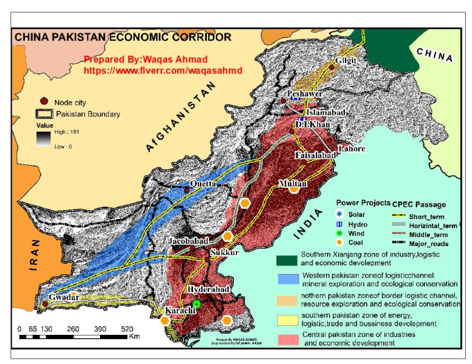
Pakistan
Nepal
5,0
(53)
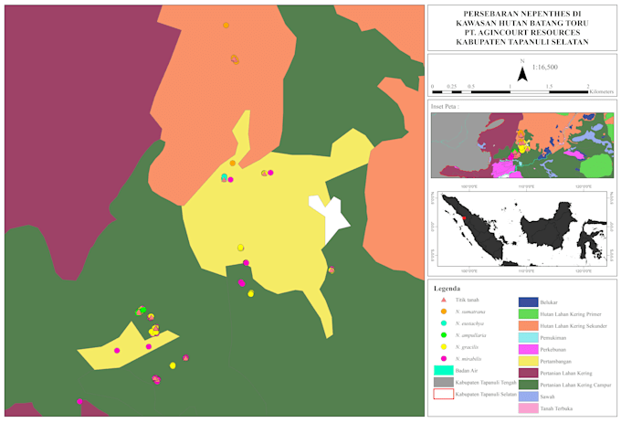
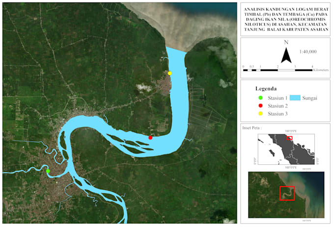
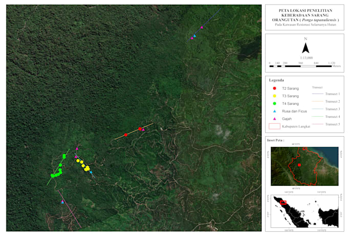
Indonesia
(23)
Sri Lanka
3,7
(3)
Level 2
4,8
(957)
(5)
Stati Uniti
Brasile
Marchi che si affidano a noi: