i
ijlalfarrukh

Ijlal Farrukh

@ijlalfarrukh
4,9(14)

Level 1

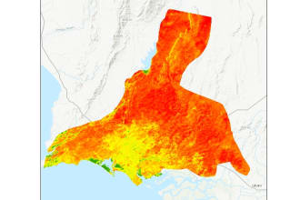
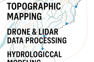
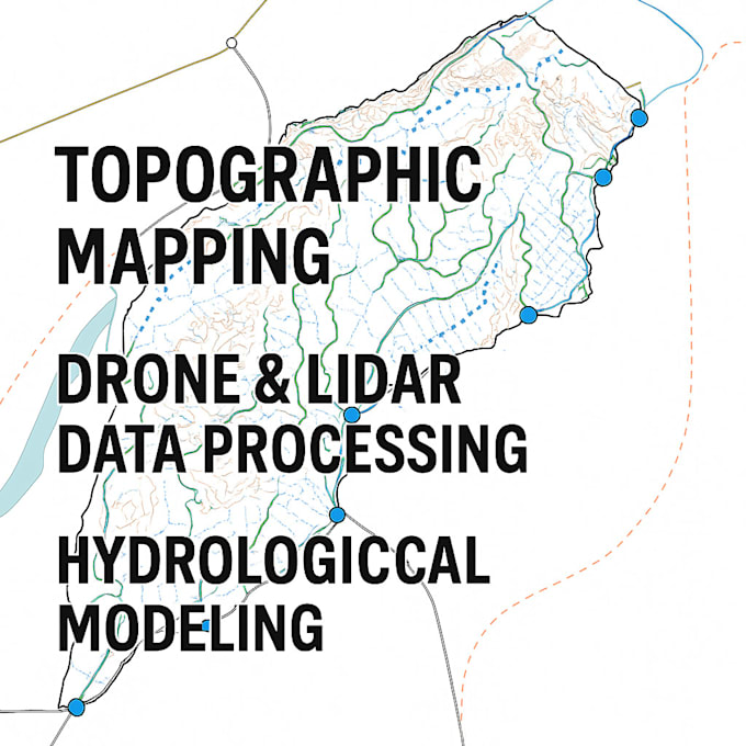
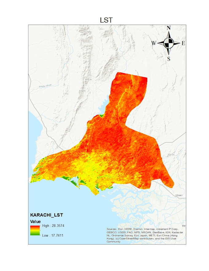
CREATE, UPDATE, ANALYZE AND MAINTAIN SPATIAL DATA

Pakistan
Alcune informazioni sono riportate in lingua inglese.
Chi sono
With 6+ years of GIS experience, I specialize in ESRI tools (ArcGIS Server, GeoServer, ArcGIS Online, ArcMap, ArcGIS Pro) and QGIS. I also offer advanced services in drone LiDAR data processing, photogrammetry, and remote sensing. Whether you need mapping, spatial analysis, or geospatial data visualization, I deliver reliable and high-quality results. My Bachelor’s Degree in Space Science and Technology with Master in Geospatial Data Science. ... Continua a leggere

Competenze

i
ijlalfarrukh
Ijlal Farrukh
15 USD/ora
offline • 
Tempo di risposta medio: 2 ore

Consulta i miei servizi

Geographic Information Systems (GIS)
I will process drone, lidar, sar data for topographic and hydrological mapping
5,0(9)
Geographic Information Systems (GIS)
I will do spatial analysis, heat map and gis mapping using arcgis pro
4,8(4)

Vuoi lavorare su base oraria?

Spiega a Ijlal Farrukh cosa ti serve.

15 USD

/

ora

14 Recensioni
4,9

(13)
(1)
(0)
(0)
(0)
Valutazione dettagliata
  • Livello di comunicazione del venditore
    4,9
  • Qualità della consegna
    4,9
  • Valore della consegna
    4,9
1-5 di 14 recensioni
Ordina per
Più rilevante