j
jibanray759

Jiban Ray

@jibanray759

Welcome Jiban World of GIS Solution

India
Inglese, Hindi, Bengali
Alcune informazioni sono riportate in lingua inglese.
Chi sono
Hi, I’m Jiban Ray – a Professional GIS Analyst, Remote Sensing Specialist & DGCA Certified Drone Pilot with 2+ years of industry experience. I help businesses, researchers, startups, and government projects transform spatial data into meaningful insights using GIS, satellite imagery, and UAV data. My Expertise: ✔️ GIS Mapping (ArcGIS, QGIS) ✔️ Satellite Image Analysis (Sentinel, Landsat) ✔️ NDVI, LULC & Change Detection ✔️ Drone Data Processing (Orthomosaic, DEM, DSM) ✔️ Georeferencing & Digitization ✔️ Spatial Data Conversion (KML, SHP, GeoJSON, GeoTIFF) ✔️ Thematic Map Creation & Reports... Continua a leggere

Competenze

j
jibanray759
Jiban Ray
offline • 
Tempo di risposta medio: 2 ore

Consulta i miei servizi

Programmazione e tecnologia
I will georeference and digitize maps for your gis project
Dati
I will do high quality gis maps, spatial analysis

Portfolio

Esperienza lavorativa

GIS Analyst and Trainer

FIDTR • Full time

Jul 2025 - Present10 mos

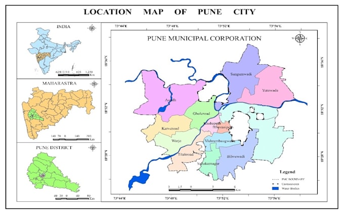
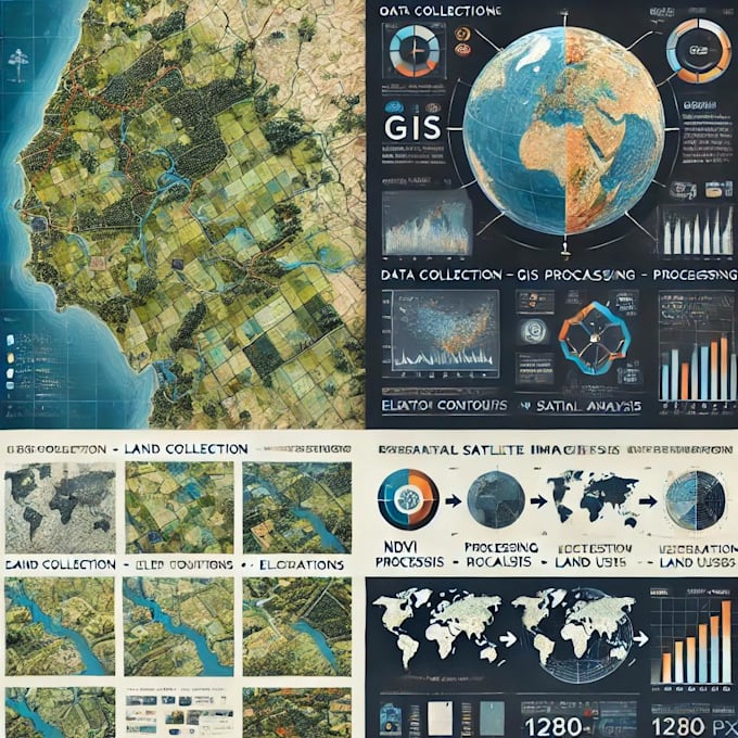
Conducted GIS & Remote Sensing analysis using Sentinel-1, Sentinel-2, Landsat, and vector datasets for agriculture and environmental applications. • Created NDVI, LULC, vegetation health, and change detection maps to support land use planning and crop monitoring. • Utilised Google Earth Engine (GEE) for cloud-based, large-area and time-series geospatial analysis. • Processed UAV/drone data, generating orthomosaics, DEM/DSM, and 3D models for mapping and analysis. • Produced high-quality thematic maps and analytical reports for decision-making. • Conducted training and hands-on sessions on GIS, Remote Sensing, UAV mapping.