Sfoglia categorie
Esplora
Fiverr Pro
Italiano
$
USD

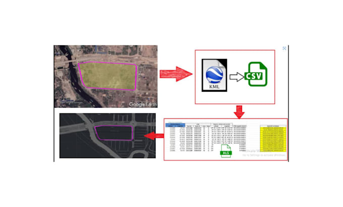
Stuck with a KML file that your architect or engineer cant use?
Google Earth is great for visualization, but its a nightmare for construction and design. If you try to build or plan using raw KML data, you'll quickly find that the scales are off, the coordinates don't align, and the file lacks the professional layers required for AutoCAD.
I provide a seamless, high-precision conversion service to turn your Google Earth KML/KMZ data into professional, layered, and georeferenced AutoCAD DWG/DXF files.
WHAT I OFFER
Stop fighting with incompatible files. Let me handle the technical conversion so you can get back to designing.
Please message me and attach your KML/KMZ file before ordering.
Let Get Started
Click the Contact Me button now
Fiverr non seleziona freelance in questa categoria. Verifica le qualifiche e discuti dei requisiti con il freelance prima di effettuare l'ordine, incluse eventuali preferenze in merito all'uso di strumenti di IA.
Land surveying and geospatial
Lingue
