Sfoglia categorie
Esplora
Fiverr Pro
Italiano
$
USD



Traduzione automatica.
Le mappe statiche ti dicono dove sono le cose. Le mappe interattive ti spiegano perché sono importanti.
Se vuoi colmare il divario tra analisi GIS complesse e un'interfaccia web facile da usare, hai trovato l'esperto giusto. Con oltre 7 anni di esperienza come Spatial Software Engineer, mi specializzo nel trasformare dati grezzi da QGIS e ArcGIS Pro in applicazioni web interattive e ad alte prestazioni che supportano decisioni reali.
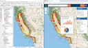
Da aver sviluppato il Interactive USA Wildfire Dashboard a gestire oltre 40 progetti globali, so esattamente come gestire grandi dataset spaziali mantenendo un'interfaccia utente/esperienza utente pulita e intuitiva.
Cosa porto al tuo progetto:
Trasformiamo i tuoi dati geospaziali in una realtà interattiva.
GIS Developer, Google Earth Engine, Python Automation, ArcGIS Pro
Lingue
Traduzione automatica.
Traduzione automatica.
Puoi convertire il mio progetto QGIS o ArcGIS Pro in una mappa web?
Sì, assolutamente! Mi specializzo nella conversione di progetti GIS desktop (.qgz, .mxd, .aprx) in mappe web interattive completamente funzionali e ad alte prestazioni usando Leaflet, Mapbox o OpenLayers. Tutti i tuoi layer, simboli e attributi saranno preservati.
Devo fornire l’hosting per la mappa interattiva?
Dipende dalle tue esigenze. Posso fornirti il codice sorgente (HTML/JS/CSS) che puoi ospitare su qualsiasi server web (GitHub Pages, Netlify o il tuo hosting). Se il progetto richiede un database come PostGIS, ti guiderò sulle migliori soluzioni di hosting.
Puoi integrare dati in tempo reale come i feed di incendi negli USA?
Sì! Ho molta esperienza nell’integrazione di feed API live da fonti come NASA FIRMS, USGS e MODIS/VIIRS. Questo permette alla tua mappa di aggiornarsi automaticamente con gli ultimi dati sugli incendi o ambientali.
La mappa interattiva funzionerà sui dispositivi mobili?
Assolutamente. Tutte le mappe web e dashboard GIS che sviluppo sono completamente responsive. Sono ottimizzate per funzionare senza problemi su desktop, tablet e smartphone senza perdere funzionalità.


