Sfoglia categorie
Esplora
Fiverr Pro
Italiano
$
USD

Traduzione automatica.
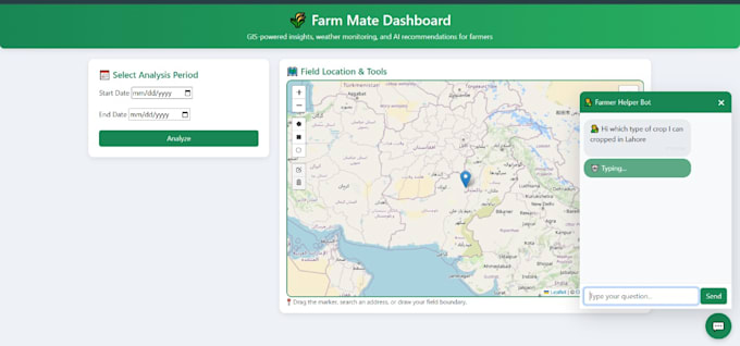
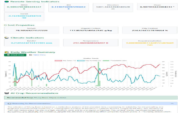
Trasforma i tuoi dati geospaziali in dashboard interattivi sorprendenti usando Python, Streamlit e Django!
Sono specializzato nella creazione di dashboard GIS alimentate dall'AI che visualizzano, analizzano e prevedono pattern spaziali in tempo reale. Che tu abbia bisogno di mappe NDVI, previsioni o classificazioni di copertura del suolo, ti aiuterò a dare vita ai tuoi dati con visualizzazioni pulite e analisi precise.
Cosa otterrai:
Stack tecnologico: Python, Streamlit, Folium, GeoPandas, Plotly, GDAL, Scikit-learn
Perché scegliermi:
Sentiti libero di contattarmi in qualsiasi momento, sono a un messaggio di distanza :)
GIS and Remote Sensing Analyst
Lingue
Traduzione automatica.