Sfoglia categorie
Esplora
Fiverr Pro
Italiano
$
USD
Computer Vision and 3D Reconstruction Engineer
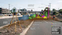
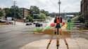
I will automate your LiDAR point cloud processing workflow to transform raw scan data into organized, classified, and analysis-ready information.
Services Include:
I work with LiDAR processing, point cloud automation, point cloud classification, LiDAR scripting, 3D data processing, LAS, LAZ, PLY, PCD, ground classification, point filtering, point segmentation, object extraction, feature extraction, scan processing, spatial analysis, coordinate transformation, elevation analysis, point cloud cleaning, batch processing, and LiDAR data conversion.
These workflows are useful for surveying, construction, infrastructure inspection, mapping, AEC, terrain analysis, forestry, robotics, industrial scanning, and research.
Whether you need a processing script, classification workflow, automated batch tool, or customized LiDAR data pipeline, I can build a solution around your data format, processing requirements, and preferred output.