Progetterò mappe, mappe arcgis e progetti gis

M
mutemit
M
mutemit
Titus Mutemi
Alcune informazioni sono state tradotte automaticamente.

Informazioni su questo servizio

Traduzione automatica.

Ciao...

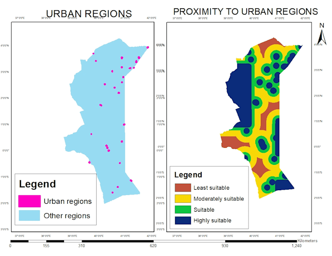
Progetto mappe topografiche, mappe analitiche, analisi spaziali e tutti i progetti ArcGIS.

Creo DEM da Google Earth, contorni e mappe del sito.

Utilizzo immagini satellitari per fare classificazioni con Erdas Imagine e ArcGIS.

Scopri di più su Titus Mutemi

Titus Mutemi

Geomatics Engineer,GIS Analyst

  • DaKenya
  • Membro dadic 2022
  • Lingue

    Inglese
Hello there..I am a trained Surveyor and GIS(Geographic Information Systems) Analyst. I hold a bachelors degree in Geomatics Engineering and GIS & Remote Sensing. I have a 6 years experience in this field and expert in using various GIS software including QGIS, ArcGIS, Global Mapper, Google Earth and related. Survey software; AutoCAD, Civil 3D. Remote Sensing software; Envi and Erdas Imagine.

Traduzione automatica.