Sfoglia categorie
Esplora
Fiverr Pro
Italiano
$
USD


Need professional drone mapping from your original aerial photographs?
I will process your drone images into georeferenced orthomosaics, elevation models and 3D mapping products for surveying, agriculture, construction and GIS applications.
SERVICES
Drone photogrammetry and orthomosaic generation
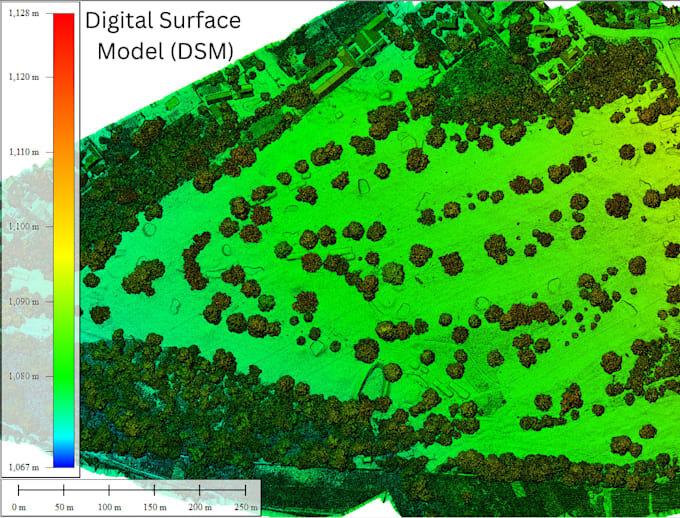
Digital Surface Models (DSM)
Digital Terrain Models (DTM), where suitable
Dense point clouds and 3D reconstruction
Contour mapping and GIS-ready exports
SOFTWARE: DJI Terra, Agisoft Metashape, Pix4D and QGIS, depending on project requirements.
DELIVERABLES: Available formats include GeoTIFF, LAS/LAZ and agreed image or GIS formats.
TO GET STARTED, provide your original drone images, approximate survey area, required outputs and coordinate reference system if known. Please also indicate whether you have RTK/PPK data or ground control points.
Image quality, overlap, terrain and survey control affect processing results and accuracy. DTM extraction and complex projects may require a custom quote.
Please contact me before ordering large datasets to confirm scope, price and delivery time.
Drone Survey, GIS and Remote Sensing Specialist
Lingue
Can you process images from my drone?
Yes, provided the images and available camera information are compatible with the processing workflow. Please share the drone and camera model where possible.
Can you produce a georeferenced orthomosaic?
Yes, if the source imagery and available positioning or control information support georeferencing. The level of positional accuracy depends on those inputs.
Can you create a DTM for landforming?
I can assess the data and determine whether a useful terrain model can be generated. Areas with dense vegetation or limited ground visibility may require additional ground data or specialist processing.
Can you process a large survey?
Yes, subject to dataset size, quality and complexity. Please contact me before ordering a large project so I can provide a suitable quote and delivery time.
Will I receive editable GIS files?
Agreed outputs can include GeoTIFF rasters, LAS/LAZ point clouds and vector files where applicable. Confirm your required formats before ordering.