Sfoglia categorie
Esplora
Fiverr Pro
Italiano
$
USD


Traduzione automatica.
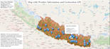
Creerò mappe web interattive usando i tuoi dati e API. Posso aggiungere marker, popup, livelli e personalizzare lo stile secondo le tue preferenze, offrendo un modo chiaro e coinvolgente per visualizzare le informazioni spaziali online.
Lingue
Traduzione automatica.
Traduzione automatica.
Quali formati di dati accettate?
Accetto Excel, CSV, GeoJSON, Shapefile o qualsiasi formato di dati geospaziali standard.
La mappa sarà interattiva?
Sì, la mappa sarà completamente interattiva con zoom, pan, marker cliccabili e popup.
La mappa può essere incorporata nel mio sito web?
Assolutamente! Fornirò il codice o i file in modo che tu possa facilmente incorporare la mappa nel tuo sito.
