Sfoglia categorie
Esplora
Fiverr Pro
Italiano
$
USD

Level 1

Traduzione automatica.
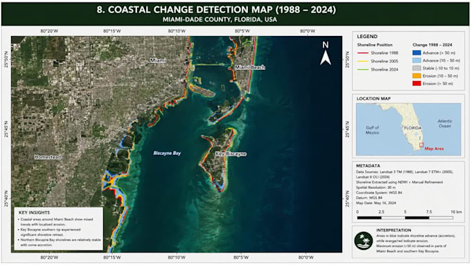
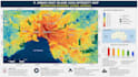
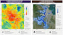
Trasforma i dati di localizzazione grezzi in insight utili con servizi esperti di GIS, Remote Sensing e GIS Mapping. Offro analisi spaziali avanzate, modellazione del terreno e cartografia pronta per la pubblicazione usando ArcGIS, QGIS e automazioni in Python. Che tu abbia bisogno di classificazione di immagini satellitari, rilevamento di cambiamenti nell'uso del suolo, routing di reti o script di geoprocessing personalizzati, converto dataset complessi in intelligence visiva chiara. Il mio workflow garantisce precisione topologica rigorosa, geodatabase ottimizzati e integrazione fluida dei dati per progetti ambientali, di pianificazione urbana e di business intelligence. Gestisco shapefile, GeoJSON, LiDAR, NDVI, statistiche spaziali e database aziendali. Sono specializzato nella generazione di ortomosaici ad alta risoluzione, modellazione idrologica, analisi di idoneità e workflow di batch processing automatizzati. I deliverable includono layout pronti per la stampa, dashboard interattivi e toolbox Python automatizzati su misura per le tue specifiche. Ogni progetto presenta georeferenziazione precisa, metadati puliti e tempi di consegna rapidi per uso accademico o commerciale. Ordina subito per soluzioni geospaziali professionali che favoriscono decisioni più intelligenti. Mappa il tuo successo oggi!
GIS and Remote Sensing Specialist
Level 1
Lingue
Traduzione automatica.
Traduzione automatica.
Devo fornire io i dati spaziali o puoi trovarli tu?
Puoi fornire i tuoi dati (Shapefile, GeoTIFF, CAD, CSV). Se ti mancano, posso reperire immagini satellitari open-source di alta qualità, dati OpenStreetMap o dataset pubblici del governo necessari per il tuo progetto.
Quale software userai: ArcGIS, QGIS o Python?
Scelgo lo strumento migliore per le tue esigenze. ArcGIS per flussi di lavoro aziendali, QGIS per flessibilità open-source e Python per automazioni avanzate e analisi spaziali complesse. Mi adatto al tuo ecosistema preferito.
Quali formati di file riceverò al termine?
I deliverable sono personalizzati per te. Fornisco formati vettoriali standard (Shapefile, GeoJSON, KML, Geodatabase), raster (GeoTIFF), layout di mappe ad alta risoluzione (PDF, PNG, JPEG) e script Python (.py) o Jupyter Notebook.
Quali analisi di telerilevamento e satellite offri?
Offro classificazione Land Use/Land Cover (LULC), analisi NDVI/vegetazione, rilevamento dei cambiamenti, classificazione supervisionata/non supervisionata, generazione di orthomosaic e processamento di immagini multispettrali.
Puoi scrivere script Python personalizzati per automatizzare i miei compiti GIS?
Sì! Scrivo script Python personalizzati usando ArcPy, PyQGIS, GeoPandas e Rasterio. Automatizzo geoprocessing ripetitivi, conversioni batch di dati e analisi spaziali complesse per risparmiarti tempo.
Quanto tempo ci vuole per completare un progetto di mappatura GIS?
Dipende dalla complessità. Mappe semplici richiedono 1-2 giorni, mentre analisi di telerilevamento o automazioni Python più complesse richiedono 3-5 giorni. Scrivimi con i tuoi requisiti per una tempistica precisa!
I miei dati spaziali e le informazioni sul progetto sono mantenuti riservati?
Sì, al 100%. Prendo molto sul serio la privacy dei dati. Tutti i tuoi dataset, informazioni proprietarie e deliverable sono mantenuti strettamente riservati e mai condivisi con terze parti senza il tuo permesso.
Cosa succede se ho bisogno di modifiche al layout finale della mappa o all'analisi?
La tua soddisfazione è la mia priorità. Offro revisioni per assicurarmi che simboli, layout, etichette, legende e risultati dell'analisi siano perfettamente in linea con le tue richieste. Controlla i miei pacchetti per i limiti di revisione.
Posso usare i tuoi deliverable per progetti accademici o commerciali?
Sì! Fornisco mappe pronte per la pubblicazione e analisi spaziali accurate, perfette per tesi accademiche, articoli di ricerca, pianificazione urbana, consulenza ambientale e business intelligence commerciale.
Il mio progetto è unico e complesso. Come possiamo iniziare?
Ogni progetto è unico! Scrivimi con i tuoi dettagli, obiettivi e bisogni di dati. Li valuterò e ti invierò un'offerta personalizzata su misura per il tuo scope e budget prima di procedere con l'ordine.