Sfoglia categorie
Esplora
Fiverr Pro
Italiano
$
USD

Level 1


Traduzione automatica.
Salve!
Se cerchi un Esperto GIS affidabile, sei nel posto giusto! Con oltre 10 anni di esperienza pratica e scientifica in GIS, offro soluzioni complete, dal concetto alla mappa finale, su misura per le tue esigenze.
Cosa Offro
Pianificazione e Implementazione GIS
Gestione dei Dati
Analisi e Visualizzazione
Design e Pubblicazione
Perché Scegliere Me?
Se hai bisogno di pianificazione di progetto, analisi dei dati o mappe di alta qualità, ci penso io.
Contattami oggi stesso!
GIS and Remote Sensing Specialist
Level 1
Lingue
Traduzione automatica.
Traduzione automatica.
Quali servizi GIS e geospaziali offri?
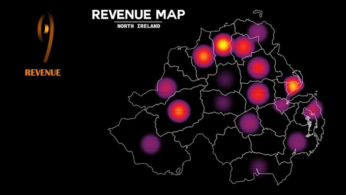
Offro analisi GIS, elaborazione di dati spaziali, mappatura digitale, cartografia, telerilevamento, analisi di immagini satellitari, mappatura dell'uso del suolo e copertura del suolo, rilevamento dei cambiamenti, analisi del terreno, geocoding, gestione di database geospaziali e creazione di mappe personalizzate usando ArcGIS, QGIS, Google Earth Engine e
Con quali formati di dati puoi lavorare?
Posso lavorare con una vasta gamma di formati geospaziali, tra cui Shapefile (SHP), GeoJSON, KML/KMZ, Geodatabase (GDB), CSV, Excel, DEM, dati LiDAR, immagini raster, GeoTIFF e molti altri formati compatibili con GIS.
Puoi creare mappe personalizzate per report, presentazioni e pubblicazioni?
Sì. Creo mappe di alta qualità e professionali adatte a ricerche accademiche, report aziendali, studi ambientali, progetti governativi, presentazioni, siti web e pubblicazioni.
Offri analisi di immagini satellitari?
Assolutamente. Posso analizzare immagini satellitari per mappature dell'uso del suolo, valutazioni della vegetazione, rilevamento dei cambiamenti, monitoraggio ambientale, agricoltura, silvicoltura, pianificazione urbana e progetti di gestione delle risorse.
Di quali informazioni hai bisogno prima di iniziare un progetto?
Di solito, ho bisogno dei tuoi obiettivi di progetto, della posizione dell'area di studio, dei dati disponibili, dei risultati richiesti, del formato preferito e di eventuali esigenze specifiche di analisi o mappatura.
Puoi aiutarmi se non ho dati GIS?
Sì. Posso aiutarti a trovare dataset pubblici adatti, immagini satellitari, DEM e altre risorse geospaziali per supportare il tuo progetto quando sono disponibili.
Offri soluzioni di web mapping interattivo?
Sì. Posso sviluppare mappe web interattive e dashboard usando tecnologie GIS moderne, permettendo agli utenti di esplorare e visualizzare dati spaziali online.
Puoi gestire progetti GIS grandi o complessi?
Sì. Ho esperienza nella gestione di progetti geospaziali complessi che coinvolgono grandi dataset, analisi spaziali avanzate, workflow di telerilevamento, automazione e soluzioni GIS personalizzate.
I dati del mio progetto rimarranno riservati?
Assolutamente sì. Tutti i dati dei clienti, i file di progetto e i deliverables sono gestiti con la massima riservatezza e non vengono mai condivisi con terze parti.
Perché dovrei scegliere i tuoi servizi GIS?
Con una vasta esperienza in GIS, Remote Sensing, analisi spaziale, mappatura e visualizzazione di dati geospaziali, mi concentro a offrire soluzioni precise, professionali e orientate al cliente che aiutano a trasformare i dati spaziali in insight utili e decisioni informate.
| (1) | ||
| (0) | ||
| (0) | ||
| (0) | ||
| (0) |

virginia2022

Stati Uniti
Naveed is exceptionally skilled at GIS and spacial data analytics. His command for programming is above par and he has a feel for the creative display of visualization of vertically integrated interface. He was able to extract data sets from my hand drawn calculations and those given in Excel format....
100 USD-200 USD
$
3 settimane
Tempo
| (1) | ||
| (0) | ||
| (0) | ||
| (0) | ||
| (0) |
virginia2022
Stati Uniti
Naveed is exceptionally skilled at GIS and spacial data analytics. His command for programming is above par and he has a feel for the creative display of visualization of vertically integrated interface. He was able to extract data sets from my hand drawn calculations and those given in Excel format....
100 USD-200 USD
$
3 settimane
Tempo