I will build web gis and interactive mapping

N
nursalam231
N
nursalam231
Ripan Nursalam
Alcune informazioni sono riportate in lingua inglese.

Informazioni su questo servizio

Ripan Nursalam | WebGIS & Spatial Developer

Fresh Talent | Ready to Build & Deploy


Portfolio Highlight

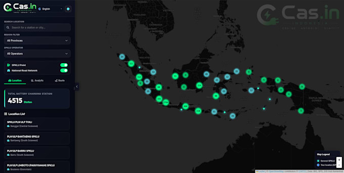
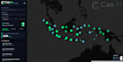
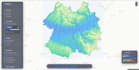
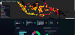
Cas.in EV Charging Station Mapping Platform (Live)

https://cas-in.nsurbanist.cloud/

Built from scratch, deployed on VPS, with routing, GPS, and battery simulation.


Core Skills

  • WebGIS & Mapping : Leaflet JS, Mapbox GL JS, OpenLayers
  • Frontend : React JS, JavaScript, HTML5, CSS3
  • Backend : Node.js, Python (Django/Flask)Spatial
  • Database : PostgreSQL, PostGISData FormatsGeoJSON, Shapefile, KML, CSV
  • Deployment : Linux, Nginx


Services I Provide

  • Custom WebGIS & Interactive Maps
  • Spatial Dashboards & Data Visualization
  • PostgreSQL / PostGIS Database Setup
  • GPS Integration & Route Planning
  • VPS Deployment (Production Ready)


Why Choose Me?

  • I deliver live, working systems not just code
  • I handle end-to-end deployment so you don't have to
  • I communicate clearly and respond fast
  • My portfolio project is live and tested


Let's Discuss First

We talk about your data, users, and budget first then I recommend the best approach.

Contact me. I reply as soon as possible.

Scopri di più su Ripan Nursalam

Ripan Nursalam

GIS Specialist, Urban Modeling, Spatial Planning , Data Analyst

  • DaIndonesia
  • Membro dagiu 2026
  • Tempo di risposta medio1 ora
  • Lingue

    Indonesiano, Inglese
My expertise lies at the intersection of AI, IT, and geospatial science. I leverage machine learning algorithms and spatial modeling to solve real-world urban challenges—from infrastructure planning to resource optimization. Crucially, I embed human oversight at every stage of the analysis, ensuring that automated insights are always grounded in practical, ethical judgment. I am driven by a singular goal: to build smarter, greener, and more inclusive cities using the power of spatial data.

Il mio portfolio