r
ravi_jatav415

Ravi J

@ravi_jatav415
India
Inglese, Hindi
Alcune informazioni sono riportate in lingua inglese.
Chi sono
I’m a GIS Specialist with over 5.5 years of experience in geospatial analysis, toposheet preparation, and georeferencing using ArcGIS, QGIS, and AutoCAD Maps. I help clients create accurate, professional maps for land use planning, infrastructure development & urban mapping. ✅ Toposheet Digitization ✅ Georeferencing Maps & Satellite Imagery ✅ Feature Extraction & Thematic Mapping ✅ ArcGIS, QGIS, Global Mapper, AutoCAD ✅ Shapefile/KML/GeoJSON Editing & Conversion ✅ Spatial Analysis, Land Use Maps, I’m committed to delivering precise and high-quality GIS outputs, tailored to your project needs... Continua a leggere

Competenze

r
ravi_jatav415
Ravi J
offline • 

Consulta i miei servizi

Grafica e design
I will create expert gis maps with qgis and arcgis in india
Grafica e design
I will georeference toposheets, old maps, map digitization and satellite imagery

Esperienza lavorativa

Sr. Graphic Designer

J M Environet pvt ltd • Full time

Jan 2017 - Present9 yrs 4 mos

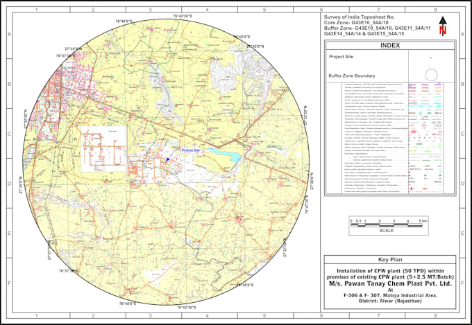
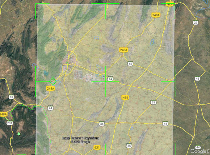
SOI Toposheets Maps & AutoCAD Layouts. Regular Working on the Softwares ( ArcGIS, Global Mapper, AutoCAD, CorelDraw & Photoshop)