Sfoglia categorie
Esplora
Fiverr Pro
Italiano
$
USD

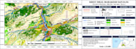
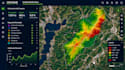
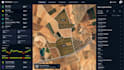
Need professional GIS mapping, cartography, digital mapping, AI-powered WebGIS, or geospatial automation? I help businesses, engineers, architects, urban planners, surveyors, researchers, environmental scientists, farmers, and government organizations transform geographic data into actionable insights.
My services include ArcGIS, QGIS, spatial analysis, geospatial data processing, satellite imagery analysis, drone mapping, remote sensing, interactive web maps, GIS dashboards, AI GIS solutions, thematic mapping, land use and land cover mapping, and automated geospatial workflows.
Whether you need location intelligence, terrain mapping, site suitability analysis, infrastructure planning, environmental monitoring, agricultural mapping, or custom WebGIS development, I can tailor the solution to your project.
I welcome clients from the USA, UK, Canada, Australia, Germany, France, Europe,Asia, and worldwide.
WHY WORK WITH ME?
Send your project requirements, study area, available data, and desired output.
WebGIS Developer
Lingue
What GIS mapping and geospatial services do you offer?
I offer GIS mapping, cartography, ArcGIS, QGIS, spatial analysis, satellite imagery analysis, drone mapping, remote sensing, digital mapping, interactive WebGIS, GIS dashboards, and geospatial data automation.
Can you create custom WebGIS applications and GIS automation workflows?
Yes, I can develop custom interactive maps and WebGIS solutions, along with suitable geospatial data processing and automation workflows based on your project requirements.
Do I need to provide my own GIS data or satellite imagery?
You can provide your own shapefiles, GeoJSON, CSV, raster files, drone imagery, or satellite data. If you do not have data, tell me your study area so we can discuss suitable data sources and availability.
Who can benefit from your GIS and digital mapping services?
I work with researchers, students, surveyors, engineers, architects, urban planners, environmental scientists, agricultural professionals, real estate businesses, and organizations worldwide.
What deliverables will I receive, and can you handle custom projects?
Depending on your package, deliverables may include high-resolution GIS maps, PDF or PNG exports, editable ArcGIS or QGIS files, spatial analysis results, or an interactive WebGIS solution. Please contact me before ordering complex drone mapping, AI, or automation projects.


