Sfoglia categorie
Esplora
Fiverr Pro
Italiano
$
USD


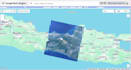
Are you looking for accurate land cover classification using remote sensing data? I offer classification services using the Random Forest algorithm in Google Earth Engine (GEE) to help you extract valuable land use/land cover (LULC) information for your research, environmental analysis, or GIS project.
What I need from you:
Lingue
Do I need to provide training data?
If you have training data (e.g., points or shapefiles with labeled classes), feel free to share it. Otherwise, I can generate training data based on visual interpretation and known land cover features in your area.
How accurate will the classification results be?
I provide accuracy assessment using a confusion matrix and kappa coefficient. Accuracy depends on the quality of training data and the heterogeneity of your area of interest.
In what format will I receive the final output?
You will receive the classification result in GeoTIFF or Shapefile format. I can also provide a visual map layout (PDF or PNG) upon request.


