Sfoglia categorie
Esplora
Fiverr Pro
Italiano
$
USD


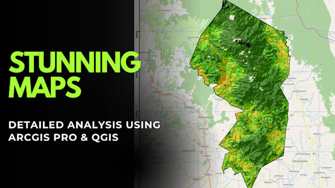
I will help you analyze spatial data and answer real-world questions using industry-standard GIS tools like ArcGIS, QGIS, and Python-based spatial analysis, delivering clear maps and actionable insights to support informed decisions.
This service is ideal if you need to:
What You'll Receive:
Common Analyses Include:
I leverage industry-standard GIS tools to ensure accuracy and reliability, but you receive results that are easy to understand and use for planning, reporting, or decision-making.
Contact me first to discuss your data and objectives
I build decision ready GIS systems for governments and businesses
Lingue
Can you help in data collection?
Yes, I will help in data collection if you do not have it. I am well familiar with different geospatial data sources that will help in completing the project.
Can I request changes after my analysis is delivered?
Yes! I offer revisions during the analysis phase to ensure your results meet your needs. Post-delivery tweaks are also possible—simply reach out, and I’ll guide or implement updates.
How are updates or future changes handled?
I provide post-delivery support for minor updates, troubleshooting, or data refreshes. For larger updates, we can arrange a follow-up project. I’ll always clarify the scope and cost before proceeding.
What types of projects can you handle?
I work on planning, land management, infrastructure, and environmental projects. Common analyses include site suitability, buffer/proximity, land use/zoning, and risk mapping.
How long does a project typically take?
Small analysis (1–2 layers, simple outputs): 2–4 days Medium analysis (multiple layers, custom outputs): 5–10 days Large/complex analysis (detailed modelling, multiple outputs, data prep): 10–20+ days I provide an estimated timeline before starting every project.
Will the maps and results be understandable to non-GIS users?
Absolutely! You’ll receive clear maps, visual outputs, and interpreted results, with practical recommendations—no technical jargon required.
Should I contact you before ordering?
Definitely! Message me first to discuss your objectives, data, and timeline, so I can advise on the best approach and provide a realistic delivery estimate.
| (1) | ||
| (0) | ||
| (0) | ||
| (0) | ||
| (0) |

maga2020
Cliente abituale

Stati Uniti
knocked it out of the park again. Thank you!
50 USD-100 USD
Prezzo
5 giorni
Tempo
| (1) | ||
| (0) | ||
| (0) | ||
| (0) | ||
| (0) |
maga2020
Cliente abituale
Stati Uniti
knocked it out of the park again. Thank you!
50 USD-100 USD
Prezzo
5 giorni
Tempo