Sfoglia categorie
Esplora
Fiverr Pro
Italiano
$
USD


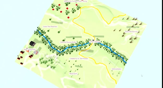
In this Gig, we will provide you, a set of drone images application services
We can
· Map your area with drone images
· DSM/ DTM/ DEM Generation
· Plantation health monitoring
· 3D reconstruction of your area (accurate and photorealistic)
· Land Use Land Cover Mapping
· Crop type detection and analysis
· Water body mapping
· Water quality assessment
· Crop disease monitoring
· Urban mapping
· City 3D modelling
· Vegetation canopy analysis
· Change detection
· Temporal analysis
· Terrain mapping
· 3D modeling
· Forest monitoring
· Coastal monitoring
· Plant counting
· Weed coverage identification
· Information extraction and mapping
· And many more
we are capable of processing historic aerial images also. if you have old black-and-white aerial images, scan them and send them to us, and we will make a digital 3D model for you.
please contact our team before place the order
~~Nayanika
Informa il freelance di eventuali preferenze o preoccupazioni relative all'uso di strumenti di IA nel completamento e/o nella consegna dell'ordine.
Remote Sensing GIS Expert
Lingue