Alcune informazioni sono riportate in lingua inglese.
Chi sono
I’m specialist with a MS Remote Sensing & GIS. I offer a wide range of GIS and Remote Sensing services, including:
🗺️ Thematic and Land Use/Land Cover (LULC) mapping
🌾 Vegetation, NDVI, and Change Detection analysis
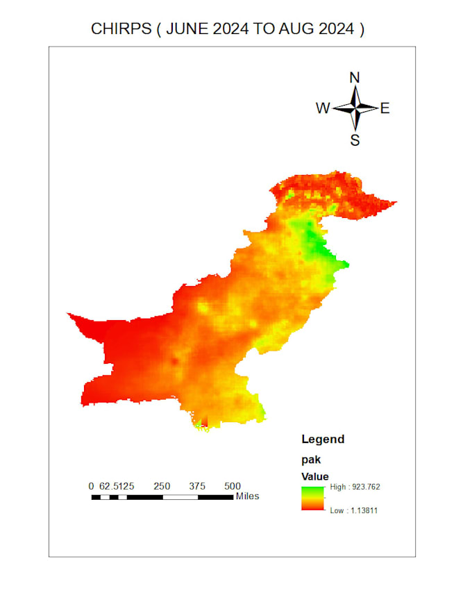
📊 Spatial and Statistical Data Analysis
📍 Georeferencing, Digitization, and Map Layout Design
🏞️ Watershed, Terrain, and Hydrological Modeling
🛰️ Image classification, enhancement, and PCA interpretation
🧾 Technical and Analytical Report Writing*
My approach is professional, detail-oriented, and focused on delivering reliable, high-quality results on time.... Continua a leggere