Sfoglia categorie
Esplora
Fiverr Pro
Italiano
$
USD

GIS and Land Surveying Specialist, Mapping, Spatial Analysis and Technical Repor
Competenze
Consulta i miei servizi
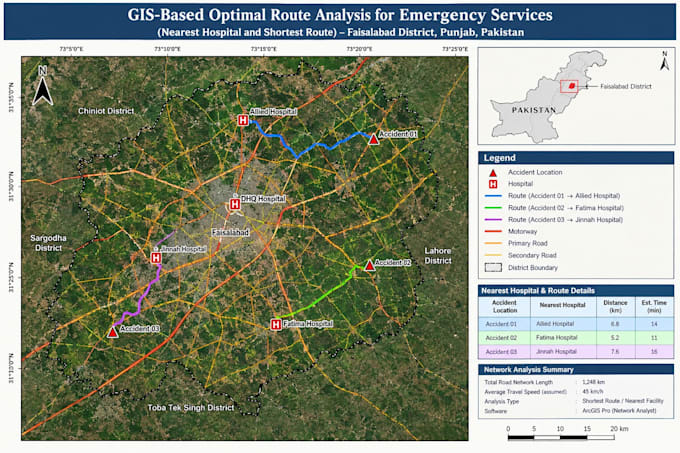

Job Title: GIS & Remote Sensing Specialist Company Name: Geo Mapping Solutions Employment Duration: 1.5 Years Description: Worked on GIS mapping, geospatial data processing, and land surveying projects. Responsibilities included processing GPS/GNSS survey data, managing Ground Control Points (GCPs) and benchmarks, preparing topographic survey outputs, creating professional maps, and performing spatial analysis. Also contributed to satellite image analysis, geospatial data management, and technical report writing to support surveying, land management, and environmental projects.
Geographic Information Systems Business Expansion Services • Full time
Mar 2025 - Present • 1 yr 7 mos
**Job History – Geo Mapping Solutions** Worked as a GIS & Remote Sensing Specialist for 1.5 years, contributing to GIS mapping, land surveying, geospatial data processing, and technical documentation. Responsibilities included GPS/GNSS survey data processing, Ground Control Point (GCP) and benchmark management, topographic survey support, map preparation, coordinate conversion, and survey report writing. **Key Achievements** - Prepared professional GIS maps and survey deliverables. - Supported GCP and benchmark data management for survey projects. - Processed geospatial and survey datasets for mapping applications. - Contributed to technical reports and project documentation. - Applied GIS tools to improve the presentation and organization of spatial data.
