Hi! My name Is Ziad Raza and i am an authorized GIS Analyst having experience of more than 7 years in Geo Spatial Analysis services like Photogrammetry, Photointerpretation, Landuse/Landcover Planning with devotion and dedication. I have provided my services to different Government, Semi-Government public and Private firms.
i offer a list of GIS Mapping Services:
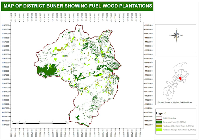
- i will develop Landuse Landcover (LULC) maps
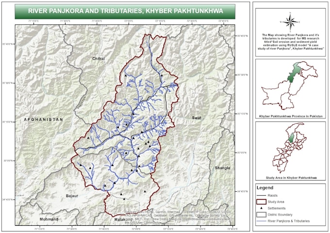
- i will produce study Area maps for research studies.
- i will do satellite image classifications in different Landuse classes adopting both pixel based and object based image analysis approaches.
- I will create any real estate databases or spatial analysis, urban plans geo-referecing and mapping
- i will Manage and convert Geo-Spatial Data
- I will do data extraction or mapping (digitization) from scanned maps, images or aerial imagery, including geo-referencing
- I will do any photogrammetry, photo interpretation mapping or processing.


_xjcxpo.jpg)